This is another of GA’s guides, this time to the geology and geomorphology of the popular holiday destination of the Castleton Area in Derbyshire. I love this area and have visited there both for the geology and the beautiful scenery.

This is another of GA’s guides, this time to the geology and geomorphology of the popular holiday destination of the Castleton Area in Derbyshire. I love this area and have visited there both for the geology and the beautiful scenery.
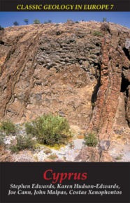
The island of Cyprus is a truly classic area of geology in Europe. Perhaps nowhere else on Earth does so small an area provide such an excellent illustration of the dynamics of Earth processes through abundant exposures of spectacular and diverse geology.
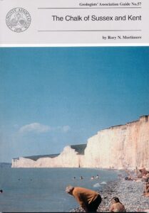
This was the first GA guide I ever bought, and I suspect it is still the best. My copy is more than well-thumbed and water-damaged, through many a happy trip to the south of England to collect, what a friend describes as “white fossils in white rock”.
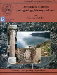
The Geologists’ Association have extended their excellent series of geological guides by producing what some people (including me) would think at first was a slightly self-indulgent couple of volumes on ‘Devonshire Marbles’. However, for my part, I soon realised that this view is entirely wrong.
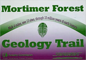
This small, yet informative, booklet takes you on a four-mile walk to 13 sites and through 15 million years of Earth history. The Mortimer Forest Trail is a geology trail in Shropshire that is famous for its outstanding fossils and varied geology. The trail mostly examines Silurian formations such as the Wenlock and Ludlow series.
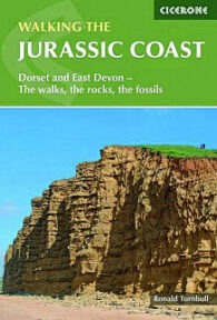
There are a lot of guide books to the Jurassic Coast Work Heritage Site and I have reviewed several on this site. This one is intended to provide a useful introduction to the general geology of the coastline, dealing with its formation, fossils and plate tectonics (among many other things). Specifically, the advice is provided in the context of walks – for both afternoon rambles and long distance hikes for the more committed.
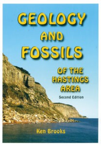
I remember buying the first edition of Ken Brook’s fascinating little guide on Hastings a long time ago, and bumbling off to Hastings in the hope of finding Lower Cretaceous dinosaurs and tree ferns.
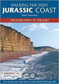
In recent years, the Jurassic Coast Trust really has produced some great books and I have had the privilege of reviewing quite a number of them. These two companion books are intended as walking guides to the World Heritage Site – the so-called ‘Jurassic Coast’ – and the first covers the western limb from Orcombe Point to the Fleet, while the second deals with the eastern part, from Portland to Studland.
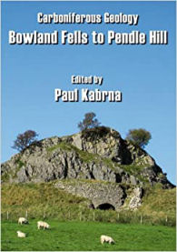
This is an odd, but nice little book, covering the geology of the Craven Lowlands, an that area is somewhat ignored, geologically. This may be true and, as much of this area is covered by Areas of Outstanding Natural Beauty, it therefore seems a great area for a geologically minded to go to for a holiday.
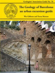
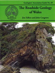
The Geologists’ Association is making something of a name for itself when it comes to pushing the envelope in geological publishing in the UK. It has already produced guides to the geology of non-UK locations and I have reviewed a new guide to the roadside geology of Wales. In itself, that was quite a departure, but so is the book under review – a guide to the ‘urban geology’ of Barcelona.
The Geologists’ Association has produced yet another great guide, this time on the geology of Wales. However, this is a slightly different beast from most of their other publications. As is always the case with this excellent series of guides, the book describes the geology of different sites capable of being visited. However, this time, the conceit is that visiting the locations is assumed to be by car.
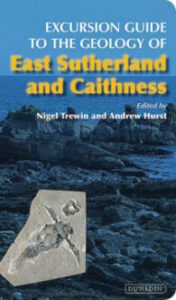
The Caithness area of Scotland is important for its geology, but is also well known for its palaeontology. The Caithness Flagstones are famous for fossil fish and the Helmsdale Fault for the Helmsdale Boulder Beds deposit, beside an active submarine fault scarp. The area even once had its own ‘gold rush’ and you can still try your luck at panning there today at Kildonan.
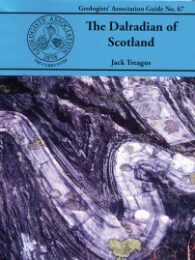
The Dalradian is a geological term describing a series of metamorphic rocks, typically in the high ground lying southeast of the Great Glen of Scotland. It was named after the old Celtic region of Dál Riata (Dalriada) by the geologist, Sir A Geikie, in 1891, and the term now covers a range of metamorphic rocks.
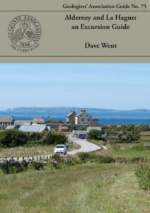
Recently, the Geologists’ Association kindly sent me three of their new guides to review, and I chose to review Alderney and La Hague: an Excursion Guide first, for some very personal reasons. I remember fondly my visits as a child to Alderney, and my extensive civil engineering works on Corblets beach, building dams of sand to capture the water flowing across the sand into the Race of Alderney.
There are several passions in my life – geology and geomorphology being a couple and hillwalking being another. And it doesn’t take much to see that that these go together rather well. Over the last few years, a number of great leaflets, often laminated, have been produced setting out UK geological walks and these are some more good ones.
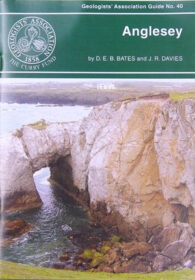
Anglesey contains a fascinating variety of rock types and geological structures, best exposed in a magnificent coastline. The bedrockgeology of Anglesey comprises a complex collage of igneous, sedimentary and metamorphic rocks that were formed between 300 and 650 million years ago.
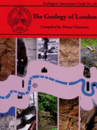
I like the GA guides. They are excellent resources for amateurs and professional geologists alike. I frequently browse mine, planning geological trips I will probably never take, because I live in geological unexciting London. Therefore, imagine how pleased I was to receive a GA guide to the Great Metropolis to review.
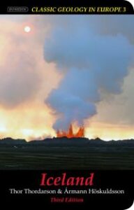
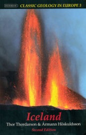
Iceland seems to set the hearts of certain geologists racing and, reading this field guide, it is abundantly clear why. Set out in this concise and authoritative book is the evidence of how this strange piece of rock – astride the Mid-Atlantic Ridge – is a “natural laboratory”, where the earth sciences can be watched in dramatic real-time.
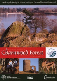
This latest publication from the British Geological Survey follows the success of its earlier publication, ‘Exploring the Landscape of Assynt’. It consists of a special pack containing both an explanatory booklet and a new 1 : 25,000 scale geological map of the Charnwood Forest and Mountsorrel area.
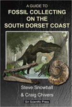
Just a couple of days before the Covid-19 lockdown, I was with friends at Tidmoor Point collecting wonderful pyrite ammonites from the Oxford Clay with this excellent guide to the South Dorset Coast. The South Dorset Coast runs from the West Fleet (of Chesil Beach fame) to and including the Isle of Portland.
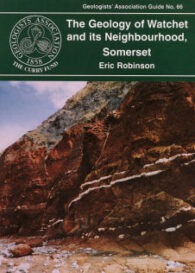
For a long time, Watchet has been known as a superb location for those interested in both fossils and geology, but, surprisingly, the location has had little in the way of media attention. However, within the last couple of years, this area has begun to attract a lot of interest and this little book will further increase its growing popularity.
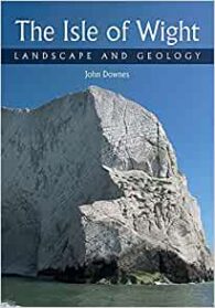
This is another guide in the excellent “Landscape and Geology” series of local geological guides published by The Crowood Press. And this is as good as the others. Admittedly, it has a wonderful subject matter, because the Isle of Wight is a geological gem with its 110km long coastline displaying a range of rocks dating from Lower Cretaceous to Oligocene age. I know from personal experience that many of its sands and clays contain collectable fossil bivalves and gastropods, and its famous dinosaur footprints attract attention from both geologists and tourists, with always the possibility of finding a bone or two.
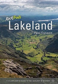
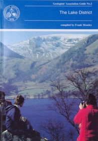
Geologists’ Association Guide No 2 Compiled by Frank Moseley The Lake District is obviously a prime UK holiday hotspot and, each year, thousands of people visit to enjoy the walking and scenery. Equally obvious is the fact that these activities are possible as a direct…
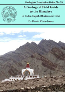
This book has something of an aspirational, rather than practical, feel to it. However, there is no doubt – in my mind anyway – that it is the best book on the geology of the Himalaya I have read. It is written with a nice light touch, with some humour. And it covers far more than just geology – where appropriate, it includes history, especially about the exploration of the subcontinent, and Asian culture.
I reviewed the 2nd edition of this guide a while ago and as I said then, iceland seems to set the hearts of certain geologists racing and reading this field guide and that previous incarnation it is abundantly clear why. Iceland’s fascinating geology is clearly set out in this concise and authoritative book. The island, astride the Mid-Atlantic Ridge, is a ‘natural laboratory’ where the earth sciences can be watched in real-time. Rifting of the crust, volcanic eruptions and glacial activity are among a host of processes and features that can be observed in this fascinating land.